All I did was put out an additional air-freshener because the one in use was running low and –– SHOCK-HORROR!! –– I unleashed this Miserable Loo Monster!

All I did was put out an additional air-freshener because the one in use was running low and –– SHOCK-HORROR!! –– I unleashed this Miserable Loo Monster!

CHRISTMAS BELLS
I heard the bells on Christmas Day
Their old, familiar carols play,
And wild and sweet
The words repeat
Of peace on earth, good-will to men!
And thought how, as the day had come,
The belfries of all Christendom
Had rolled along
The unbroken song
Of peace on earth, good-will to men!
Till ringing, singing on its way,
The world revolved from night to day,
A voice, a chime,
A chant sublime
Of peace on earth, good-will to men!
Then from each black, accursed mouth
The cannon thundered in the South,
And with the sound
The carols drowned
Of peace on earth, good-will to men!
It was as if an earthquake rent
The hearth-stones of a continent,
And made forlorn
The households born
Of peace on earth, good-will to men!
And in despair I bowed my head;
"There is no peace on earth," I said;
"For hate is strong,
And mocks the song
Of peace on earth, good-will to men!"
Then pealed the bells more loud and deep:
"God is not dead, nor doth He sleep;
The Wrong shall fail,
The Right prevail,
With peace on earth, good-will to men."
Being now almost now that eve of eves, means it is time to watch, yet again, my
favourite Christmas films – in fact one of my all-time favourite films whether it's Christmas or not! – Frank Capra's eternally satisfying and
edifying 1946 masterpiece, It's a Wonderful Life.


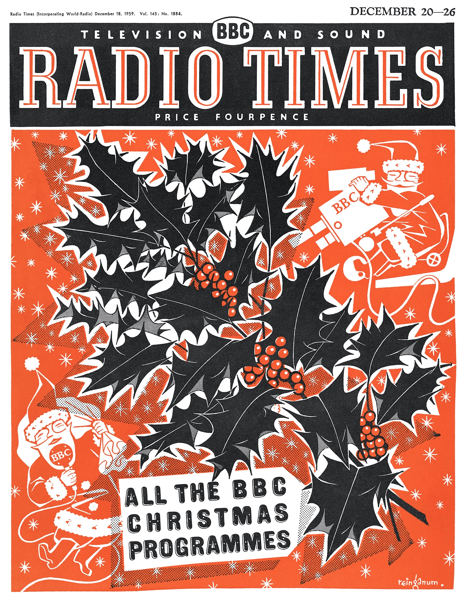
Remember those days in the Twentieth Century when the arrival of the Christmas Issue (later 'Bumper Issue') of Radio Times signaled the true beginning of seasonal festivities?
Historically, Radio Times was always a showcase for the work of some of the finest graphic and illustrative artists of the age and examples of their work is showcased in this very personal selection of classic covers from before-my-time, but by artists whose work I love – John Gilroy (he of the classic Guinness posters), Rex Whistler, Edward Ardizzone and Eric Fraser; from my childhood and adolescent years – C. Walter Hodges, J. S. Goodall, Ronald Searle, Rowland Hilder, Victor Reinganum and, again of course, Eric Fraser; and, lastly, from more recent years – the impeccable art of Tony Meeuwissen and a wonderful cavalcade of Santas and Snowmen by my friend, Mick Brownfield.
Among the later are his Father Christmas and Dalek cover and the alternative variant Strictly Come Dancing version for families with tiny tots who were scared of Doctor Who's inter-galactic, mechanical nemesis!


Eric Fraser, 1958


When my friend, French Disney scholar Christian Renaut, visited me last month, he gave me a very special gift: a copy of the famous 24 December 1966 issue of the French magazine Paris Match featuring a grieving Mickey Mouse to mark the death of Walt Disney, nine days earlier.
The iconic cover painting was by French comic book artist, Pierre Nicolas, and the magazine contained a lengthy appreciation of the American filmmaker under the title, 'Adieu a Walt Disney - Il a Bati Un Empire Sur Une Souris'. Although very aware of this image – one that spoke to the global shock with which people received the news of Uncle Walt's death – I had never owned a copy.
I am twelve years old and I'm getting ready for school and, suddenly, there is my father calling up the stairs: 'Brian... Walt Disney has died!'
Downstairs I can hear the murmuring drone of radio voices as my father –
busy brewing early-morning tea – listens, as he does every morning, to
the BBC Radio news programme, Today.
Maybe I should have have dashed downstairs to catch the reports, absorb
the details, gather up the tributes. After all, Walt Disney was my
hero. A strange idol for a young lad, maybe – but that is what he
was.
I collected every book, magazine and trivial snippet that I could find
about Disney and his studio. I was forever copying pictures of Disney
characters in my sketch-books – in fact my youthful ambition was to be a
Disney artist, to animate those fabulous beings that appeared in his
films. I longed to be a part of that mystical process that created
characters out of pencil, ink and paint and then imbue them with a power
to move people to laughter or tears. I was, I admit, obsessed by the
man and his movies.
Later that morning, on my way to school, I would buy the daily
newspapers and – in a corner of the playground at morning break – pore
over the obituaries; but, at the moment of first hearing the news, I had
only one response: I sat on the edge of my bed and, like Paris Match's Mickey Mouse, I cried.
 For
the first time in my young life I experienced that bizarre phenomenon: a
feeling of overwhelming grief at the death of someone whom I did not
really know. Not only had I never met Walt Disney, I had – rather
surprisingly – never even written him a fan-letter. Yet, I felt, as
many others have felt on hearing of the death of some public figure,
president or pop-star – that I had lost a friend, been bereaved of
someone who held a unique place in my affections. The loss felt
achingly huge; a void had yawned open in my life that I doubted could
ever be filled...
For
the first time in my young life I experienced that bizarre phenomenon: a
feeling of overwhelming grief at the death of someone whom I did not
really know. Not only had I never met Walt Disney, I had – rather
surprisingly – never even written him a fan-letter. Yet, I felt, as
many others have felt on hearing of the death of some public figure,
president or pop-star – that I had lost a friend, been bereaved of
someone who held a unique place in my affections. The loss felt
achingly huge; a void had yawned open in my life that I doubted could
ever be filled...
In the four-and-a-half decades since that day, I have continued to study
– and occasionally write about – Disney's life and work. I have also
had the privilege of meeting many of those who knew, worked with, loved
and (sometimes) loathed the man. Such encounters have brought me very
close to feeling that I understand at least something of the unique
personality and character that was Walter Elias Disney.
But I have never been – never shall be – as close to him as I was on
that morning when my father called upstairs to tell me the news that
Walt Disney had died...

That memory triggers another from six or seven years later...
My early fascination with Disney movies had been suddenly intensified when I borrowed R D Feild's book, The Art of Walt Disney
from my local library. Here was someone who, unlike my Mum, didn't
think of 'cartoons' as kid's stuff you ought to have grown out of by the
time your voice breaks.
I wanted a copy of The Art of Walt Disney more
than anything else in the world and began scouring the second-hand
bookshops, which is how I stumbled on Fred Zentner. He later became The
Cinema Bookshop in London’s Great Russell Street, but when I first met
him he was selling film books, stills, posters and other gems –
including a copy of the much-lusted-after Art of Walt Disney
– from the basement of the Atlantis Bookshop, in Museum Street, just
round the corner from the British Museum. Once found, I began, bit by
bit, buying up Fred's stock of Disneyana.
Then came the day when he placed into my hands a copy of The Story of Walt Disney
by Walt's daughter, Diane Disney Miller, as told to Pete Martin. It was
a first edition American hardback, published by Henry Holt & Co
(New York) in 1956. It still had its original dustwrapper with a
portrait of Walt by studio artist, Al Dempster...


This blog post is based on an earlier posting from December 2012, since when David R. Smith and Diane and Ron Disney have passed away.
For the story of the making of the Paris Match cover-painting see this interview with artist Pierre Nicholas by my colleague, Didier Ghez on his blog, Disney History.

Dan Mora's art (Cover A) for Batman/Santa Claus: Silent Knight #1. Published, DC Comics, December 2023.
I'm still waiting for my copy, but here's what we know about the comic:
SANTA CLAUS IS COMING TO TOWN!
The four-part crossover event of a generation begins when a not-so-jolly St. Nick hits Gotham City to investigate a brutal crime in the days leading up to Christmas… What manner of man or beast could have committed such atrocities?!
With the help of his former student, Batman, Santa will team up with the heroes of the DC Universe to right this wrong or the world wakes up to coal in their stockings!
A brutal, two-fisted holiday tale of hope, wonder, and monster
hunting is the perfect treat to ring in the holidays it’s Claus in
canon!
And here's a scattering of preview pages, written by Jeff Parker with art by Michele Bandini.


And to add a little Christmas nostalgia, here's a seasonal Batman comic cover from days of yore, beginning with Batman # 27 from (curiously) Feb-March 1945...

December 12th:
HAPPY GINGERBREAD HOUSE DAY!

Illustration:
Kay Nielsen (18886-1957) from Hansel and Gretel and Other Stories by
the Brothers Grimm (1925)
The tradition of making decorated edible houses from gingerbread began in Germany in the early 1800s, allegedly popularised following the publication, in 1812, the dark fairy-tale of Hansel and Gretel as told by the Brothers Grimm. In the tale, the abandoned children, lost in a wood, discover original the house "built of bread, and roofed with cakes, and the window was of transparent sugar.” In later tellings, the bread became gingerbread inspiring German bakers to craft small decorated edible houses from lebkuchen, the popular spiced honey biscuits.
"...It was now three mornings since Hansel and Gretel had left their father's house. They began to walk again, but they always came deeper into the forest, and if help did not come soon, they must die of hunger and weariness. When it was mid-day, they saw a beautiful snow-white bird sitting on a bough, which sang so delightfully that they stood still and listened to it. And when its song was over, it spread its wings and flew away before them, and they followed it until they reached a little house, on the roof of which it alighted; and when they approached the little house they saw that it was built of bread and covered with cakes, but that the windows were of clear sugar. 'We will set to work on that,' said Hansel, 'and have a good meal. I will eat a bit of the roof, and you Gretel, can eat some of the window, it will taste sweet.' Hansel reached up above, and broke off a little of the roof to try how it tasted, and Gretel leant against the window and nibbled at the panes. Then a soft voice cried from the parlour:
'Nibble, nibble, gnaw,
Who is nibbling at my little house?'
The children answered:
'The wind, the wind,
The heaven-born wind,'
and went on eating without disturbing themselves. Hansel, who liked the taste of the roof, tore down a great piece of it, and Gretel pushed out the whole of one round window-pane, sat down, and enjoyed herself with it. Suddenly the door opened, and a woman as old as the hills, who supported herself on crutches, came creeping out. Hansel and Gretel were so terribly frightened that they let fall what they had in their hands. The old woman, however, nodded her head, and said: 'Oh, you dear children, who has brought you here? do come in, and stay with me. No harm shall happen to you.' She took them both by the hand, and led them into her little house. Then good food was set before them, milk and pancakes, with sugar, apples, and nuts. Afterwards two pretty little beds were covered with clean white linen, and Hansel and Gretel lay down in them, and thought they were in heaven."
[Read more about the artist here: https://en.wikipedia.org/wiki/Kay_Nielsen ]